Maps
City Maps
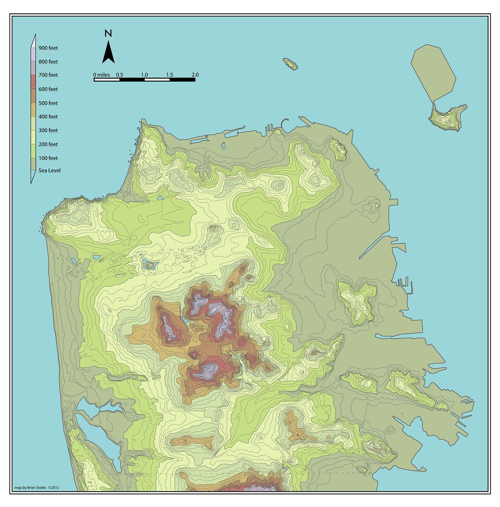
Topographic Maps
San Francisco - Atlas Style - current sea level (2012)

San Francisco - Clean Style (white)

San Francisco - Clean Style (blue)
San Francisco - 25 Foot Sea Level Rise with topography

San Francisco - 200 Foot Sea Level Rise with Streets

Transit Maps


Bay Area Current Transit (March 2012)
Bay Area Future "Fantasy" Transit

Harbor Maps
All Maps at the same scale.
San Francisco

Istanbul

Vancouver

Hong Kong

High Speed Rail Maps
California HSR - Tehachapi/Palmdale Route

California HSR - Pacheco Pass Route

California HSR - San Joaquin Valley/Stockton Route

Caltrain DTX (Downtown Tunnel Extension) Maps
Name: Planned Option: Steamboat Rincon
Route:
1: at grade alongside 7th Street
2: Tunnel under Townsend Street
3: Tunnel under 2nd Street
New Stations: 4th & Townsend, Transbay Center
Name: Planned Option: Grand Curve
Route:
1: tunnel under 7th Street
2: Curving tunnel below SoMa el under Townsend Street
3: Tunnel under Howard Street, or alignment between Minna and Natoma streets.
New Stations: Mission Bay & 7th Street, Transbay Center
Name: Planned Option: Mint Harris
Route:
1: tunnel under 7th Street
2: Curving from 7th Street and east down Mission Street
3: Tunnel continues under Mission, or aligns under both Minna and Natoma streets.
New Stations: Mission Bay & 7th Street, Transbay Center
Option 4
Option 5